On a beautiful early summer weekend Scott and I headed west to do some exploring along a bit of the Antrim Coast in Northern Ireland. We knew we wanted to do some driving, so the ferry from Cairnryan, Scotland to Larne, which is just north of Belfast, seemed an obvious choice for us. The ferry port in Cairnryan is about a 3 hour drive from our flat, so we left after work and spent the night. Early the next morning we boarded the ferry and enjoyed a beautiful, sunny, crossing over the North Sea to Ireland. We opted to take the longer, but undoubtedly more beautiful, coastal scenic drive to the Giant's Causeway and Bushmills area and we were treated to some beautiful Irish coastline scenery and fantastic weather.


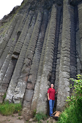
The coastal route took us through several beautiful harbour towns and eventually we arrived at the Giant's Causeway. This area is a World Heritage Site. More than 40,000 interlocking basalt columns were created during volcanic eruptions millions of years ago. Legend has it that the columns were actually built by a giant to create a footpath across the sea to Scotland. From this point the story diverges in a couple of directions, but for one reason or another, the giant ended up destroying the footpath across the sea, leaving just the columns on either side. Regardless, this was a beautiful area to walk in and we enjoyed a warm summer afternoon here.
 |
| Scott was trying to take a photo using his tripod and the timer. You can see that the footing was a bit treacherous. Scott had to quickly maneuver those rather large rocks in a very short amount of time to get into the photo. I truly didn't think he was going to make it, but here's the proof! |
One of the things we have learned in our travels is to ask the locals about things they recommend to do or see in the area. On this trip we stayed in a very nice B&B. Our hostess asked us if we were fans of the t.v. series "Game of Thrones". I have heard of it, but we really didn't know much about it. She told us that we would be passing Ballintoy Harbour and that it was used for some of the harbour scenes in Game of Thrones. She also told us that it's a very beautiful place. We did stop, and she was definitely correct about it being beautiful!
From here we went on to Carrick-a-Rede, a rope bridge connecting the tiny island of Carrickarede with the mainland. The original bridge was built by salmon fishermen to help them bring their catch to the mainland. It is no longer used by the fishermen, and the original bridge has been replaced, but it is still rather intimidating!
 |
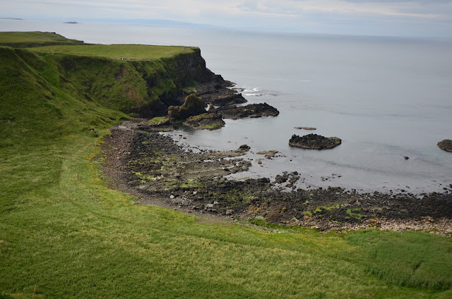
| There was a bit of a walk to get to the bridge from the parking lot. We were treated to the beautiful shoreline views! |
 |
| Hmmm.....the bridge really doesn't look that bad.....until you realize that it spans 20 metres (66 feet) and is 30 metres (98 feet) above the rocks! |
 |
Nope. I am definitely not smiling in this one! I was actually petrified! And the worst part is, once you go over it to go out
onto the island there is really no other way back :(! |
 |
| Scott, of course, enjoyed it! |
We have read that every year there are people who get across the bridge but just cannot summon the courage to come back across it, and they have to be picked up by helicopter. We did watch a couple of groups of younger people come across. In every case don't you know there was "the one" who just had to start jumping up and down to bounce everyone else around on the bridge. And there was one young lady who came across, but she was absolutely shrieking with every step. I have no idea if she completed the return journey or not! Here are a few more photos from our walk back to the car.


