Wednesday, 30 October 2013

A Long Walk!


England's tallest mountain, Scafell Pike, rises to a height of 978 metres (3,209 feet). Wast Water, England's deepest lake, is at the bottom. Scott and I often drive out to Wast Water, to enjoy the spectacular scenery. Of course there are lots of photo opportunities too! On a summer Saturday we decided to take a picnic supper and head to Wast Water.  My plan was to spend a peaceful afternoon walking on one of the trails that meanders along the lake shore, ending the day enjoying our picnic whilst watching the sunset. As often happens, though, Scott had other ideas! We arrived at the lake, found a place to park, and laced up our hiking boots. We decided to head away from the lake and chose a path that is actually part of the route to ascend this huge mountain. Our plan was to walk along for an hour or so and then turn back towards the lake.


At least that's what I thought we had decided.


After about 2 hours of walking, mostly uphill, I began to suspect Scott had thoughts of actually going to the peak. "No", I thought, "he can't be thinking that". Those who know my husband well will know now that he, indeed, was thinking that we would hike to the summit! I suppose at this point his idea was that we had already invested a couple of hours into the climb so we might as well finish it.


It was a great day weather-wise, and there were lots of fellow walkers around us. Most were going our direction, as in "up", but after awhile there were quite a few who were descending. I began to occasionally stop and ask about what was ahead of us on the climb. Of course everyone was quite encouraging. One gentleman told me, "Ye can do it lass. You're almost there." (We weren't even close!) Then he added, "But, I'm sorry to say, the pub's closed down." (There's no pub, it was a joke of course.)


Eventually, after about 4 hours of walking, climbing, and scrambling over boulders, we reached the summit of Scafell Pike!
Scott, standing at the cairn marking the summit!
The views from the top were beautiful if a bit hazy. There were quite a few folks up there resting from the climb and snapping pictures. We took our share of pictures, then turned to start our descent. Maybe it was because I was already a bit sore and tired from our ascent, but it seemed as if it was almost more difficult to climb down the mountain than it was to go up! We finally reached our car, ditched the picnic idea, and drove home for some hot showers!

Here are a couple of photos of Wast Water that Scott took on the drive back to our flat.

Wast Water

Wast Water
Well, it was a great day and it ended with a nice dinner out in town.

Friday, 30 August 2013

Our Cumbrian Summer

Suddenly, seemingly out of nowhere, the clouds which had persisted over our part of England parted and the sun finally emerged. Even more amazing, the clouds stayed away......for days and days and days. Summer had finally arrived in Cumbria! Last year we had a nice day or two every couple of weeks with the rest of the time being cool and cloudy. We never wore sandals, let alone shorts. This summer has been hot and humid, definitely "shorts and sandals" weather! We recently heard in the news that it was the nicest summer in the past 8 years. Scott and I had decided to stay in Britain this summer and see a bit more of our beautiful adopted country. As it turned out, it was a great decision! We actually live in one of the most popular vacation destinations in Great Britain: the Lake District. Beautiful lakes surrounded by tall mountains are a normal part of our scenery. Walking is a huge pastime in England, and there are all sorts of great walks one can take. Scott and I spent several weekends out and about in the fells walking, relaxing, and just enjoying being out in nature.

First up: Ennerdale Water
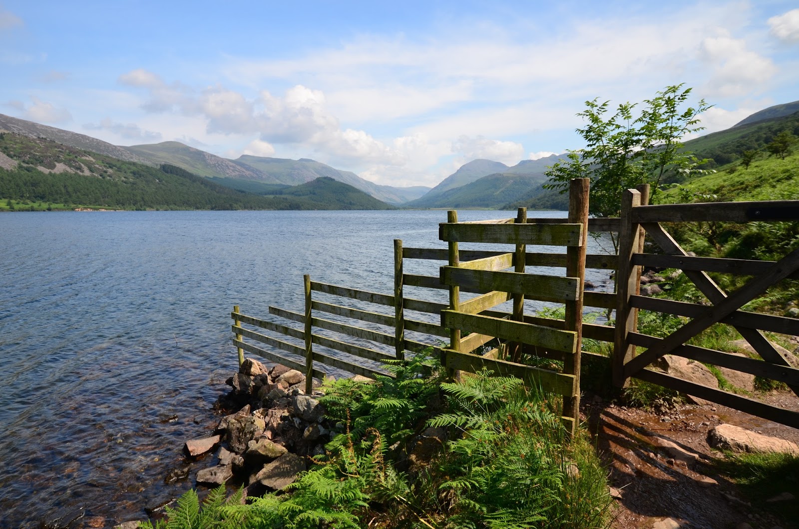
Ennerdale is the closest lake to our home in Whitehaven. It is a glacial lake, and is surrounded by some of Cumbria's tallest mountains. The circular path around Ennerdale is 6.5 miles long, and there are really no structures on the lake. It is in an area surrounded by farms, fells, and a few tiny little towns. Interesting to note, however, that it was here, at Ennerdale Water, that former President Bill Clinton proposed to Hillary!

This stream flows into the lake. 


Next: A trip to "Cat Bells" via "Maiden's Moor"
We have many friends who have told us about a wonderful walk that involves a bit of a fell climb, but nothing overly strenuous, called Cat Bells. On a beautiful Sunday afternoon we set out to do this walk. There are a couple of ways to access the path up Cat Bells, one of which involves taking a small boat over across Derwentwater. That's the option we decided on and we set off. We intended to just reach the top of Cat Bells, which would have been a nice easy climb. Somehow we ended up climbing to Maiden's Moor first, which is a bit farther along and higher. We did come over Cat Bells on our return and we were definitely not disappointed in either our walk or the views!
The boat to take us across the lake.

Our destination: Cat Bells!

Looking back along the climb. That lake is Derwentwater.

Well, we reached the ridge. Cat Bells behind me, Maiden's Moor, higher and more difficult, up in front.
Of course we chose to do Maiden's Moor first.

Beautiful views of the valley and fells beyond from near the top of Maiden's Moor.

We are standing on the top of Maiden's Moor! No, I don't have "hat head" or a new hairdo. The wind was really that ferocious up there! The views were definitely beautiful too!

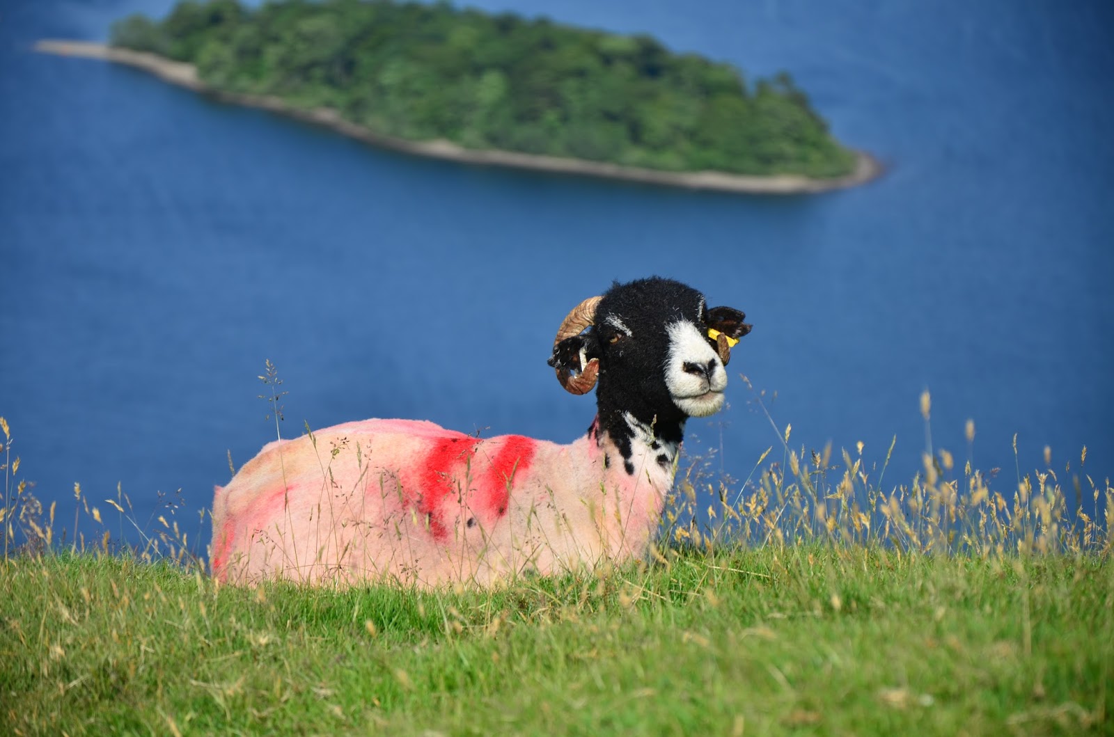
One of "the locals" we passed on our way back down to Cat Bells.

Another "local" checking us out!

We reached the bottom, hot and tired, and realized that it was well after 5:00 p.m. on a Sunday. We began to get quite concerned that another boat might not be scheduled to arrive at our stop until the next day. It's a long walk into town from where we were too! Finally, a boat came into view and did, indeed, stop and pick us up. We later learned that it was the very last boat of the day! Whew! Glad we made it!

Looking back at Cat Bells as we pulled away from the dock.
 We took one more long walk. THAT one is more of an adventure and merits it's own blog entry, coming soon!


Northern Ireland

On a beautiful early summer weekend Scott and I headed west to do some exploring along a bit of the Antrim Coast in Northern Ireland. We knew we wanted to do some driving, so the ferry from Cairnryan, Scotland to Larne, which is just north of Belfast, seemed an obvious choice for us. The ferry port in Cairnryan is about a 3 hour drive from our flat, so we left after work and spent the night. Early the next morning we boarded the ferry and enjoyed a beautiful, sunny, crossing over the North Sea to Ireland. We opted to take the longer, but undoubtedly more beautiful, coastal scenic drive to the Giant's Causeway and Bushmills area and we were treated to some beautiful Irish coastline scenery and fantastic weather.


The coastal route took us through several beautiful harbour towns and eventually we arrived at the Giant's Causeway. This area is a World Heritage Site. More than 40,000 interlocking basalt columns were created during volcanic eruptions millions of years ago. Legend has it that the columns were actually built by a giant to create a footpath across the sea to Scotland. From this point the story diverges in a couple of directions, but for one reason or another, the giant ended up destroying the footpath across the sea, leaving just the columns on either side. Regardless, this was a beautiful area to walk in and we enjoyed a warm summer afternoon here.


Scott was trying to take a photo using his tripod and the timer. You can see that the footing was a bit treacherous. Scott had to quickly maneuver those rather large rocks in a very short amount of time to get into the photo. I truly didn't think he was going to make it, but here's the proof! 


One of the things we have learned in our travels is to ask the locals about things they recommend to do or see in the area. On this trip we stayed in a very nice B&B. Our hostess asked us if we were fans of the t.v. series "Game of Thrones". I have heard of it, but we really didn't know much about it. She told us that we would be passing Ballintoy Harbour and that it was used for some of the harbour scenes in Game of Thrones. She also told us that it's a very beautiful place. We did stop, and she was definitely correct about it being beautiful!


From here we went on to Carrick-a-Rede, a rope bridge connecting the tiny island of Carrickarede with the mainland. The original bridge was built by salmon fishermen to help them bring their catch to the mainland. It is no longer used by the fishermen, and the original bridge has been replaced, but it is still rather intimidating!

There was a bit of a walk to get to the bridge from the parking lot. We were treated to the beautiful shoreline views!

Hmmm.....the bridge really doesn't look that bad.....until you realize that it spans 20 metres (66 feet) and is 30 metres (98 feet) above the rocks!


Nope. I am definitely not smiling in this one! I was actually petrified! And the worst part is, once you go over it to go out
onto the island there is really no other way back :(!

Scott, of course, enjoyed it!
We have read that every year there are people who get across the bridge but just cannot summon the courage to come back across it, and they have to be picked up by helicopter. We did watch a couple of groups of younger people come across. In every case don't you know there was "the one" who just had to start jumping up and down to bounce everyone else around on the bridge. And there was one young lady who came across, but she was absolutely shrieking with every step. I have no idea if she completed the return journey or not! Here are a few more photos from our walk back to the car.

Wednesday, 29 May 2013

A Weekend of Castles: Dunstanburgh

The Great Gatehouse
When we planned our weekend trip to Alnwick and Bamburgh we had no intentions of stopping at Dunstanburgh. In all honesty, pretty much every town in the north of England has it's own castle or castle ruin. Our hosts at the guesthouse insisted that Dunstanburgh was something special and not to be missed. They gave us directions on how to get to this castle. There are no roads here, just a nice walk from the car park along the beach.
Dustanburgh is an intriguing castle. No one really knows why it was built. It does not stand in a place of strategic military importance. Nor is it near any local villages or along any sort of main road. Historians know that it was built by the Earl of Lancaster, who was fiercely opposed to King Edward II, his cousin. Just down the beach is Bamburgh Castle, Edward II's stronghold. Speculation is that Dustanburgh was built to intimidate the King and outshine the King's castles.

Looking down inside the gatehouse.


There were steps leading to the top of the great gatehouse. I just knew
Scott would not be satisfied until he climbed up there!


The castle is nearly surrounded on three sides by fields. On the fourth side is the North Sea.


The Lilburn Tower - set on the highest point

Entrance through the gatehouse


We spent an hour or so walking through the ruins of this castle before heading back to the car. We did see some interesting sights along our walk as well.


Meet the Neighbors

This area is filled with field after field of rapeseed. The brilliant yellows were on
full display this weekend!

The beach here is beautiful and wide at low tide. 

WWII pillboxes dot the dunes along the beach. You can see the castle ruins in the background.
We have really enjoyed our relaxed weekend exploring some of the castles in the northeast of England. The three were quite different from one another and each spectacular in it's own way. We sure hope you have enjoyed them as well!